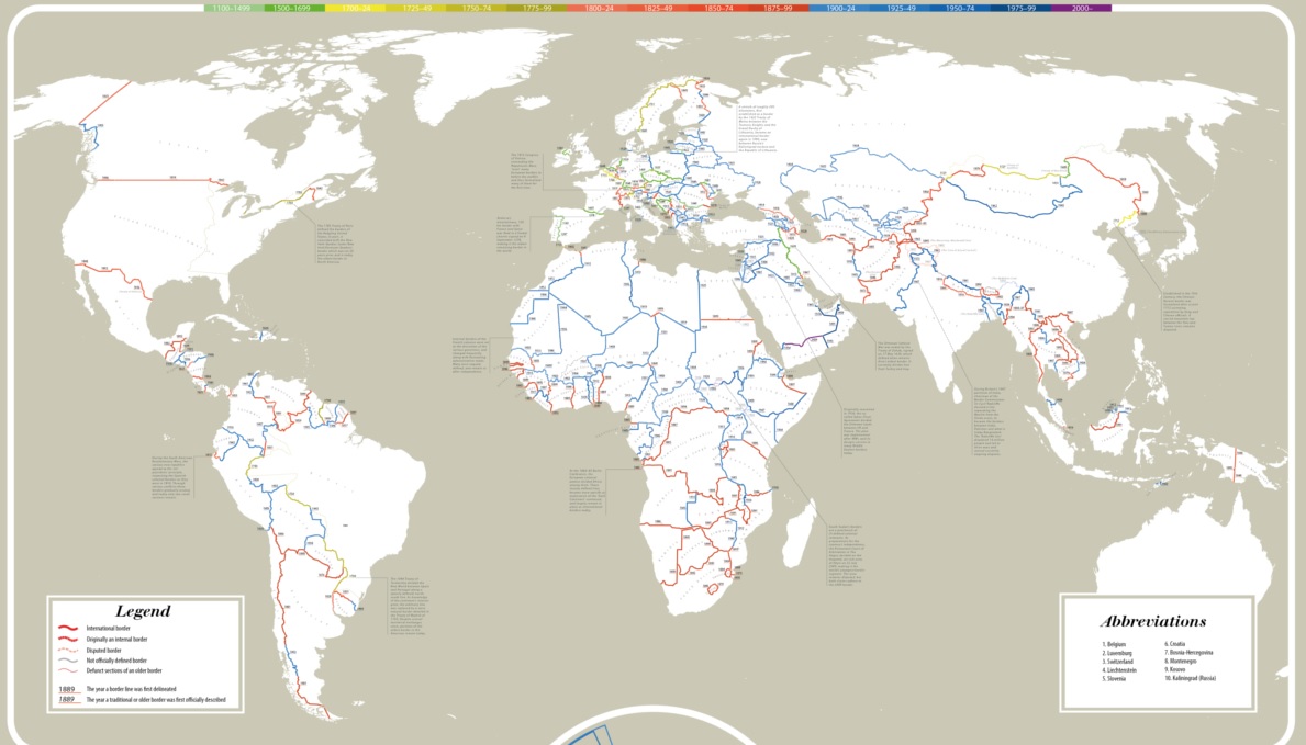
Going by distance, 52% of all international borders were first established in what century?
The first new player to comment on the website with the correct answer wins a free drink at their next iQ Trivia show.
Going by distance, 52% of all international borders were first established in what century?
The first new player to comment on the website with the correct answer wins a free drink at their next iQ Trivia show.
Comments are closed.
19th All those colonial moves and European wars.
That would have established a lot, but not a majority.
20th century (1900s)! Being driven by Africa, East Europe, and Middle East, and West Asia by the looks of the map.
A lot of those African borders are from the 1900s, which means a lot of border distance.
I would say the 19th if colonial borders count, since that century locked in most of the western hemisphere borders and carved up Africa into colonial chunks.
If it refers purely to existing national borders (which is my expectation), then I would say the 20th. The African and Asian nations popped out of their colonial existences and there were a bundle of changes in central and eastern Europe.
Sorry for the hedging of bets, but the question was not clear.
Some of the old borders from colonial times still applied, but a lot of them were newly cast in the 1900s. Apparently enough to make a majority.